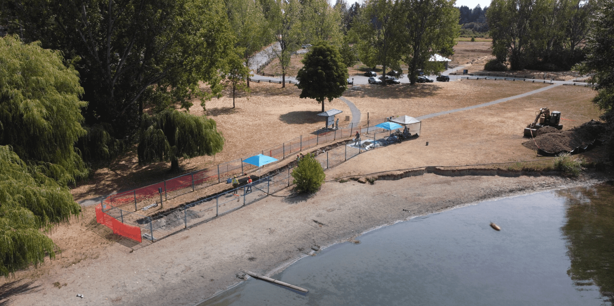
XEOLXELEK (Elk Lake) fault trenching, Victoria, Canada (Photo by: Andrew J. Schaeffer)
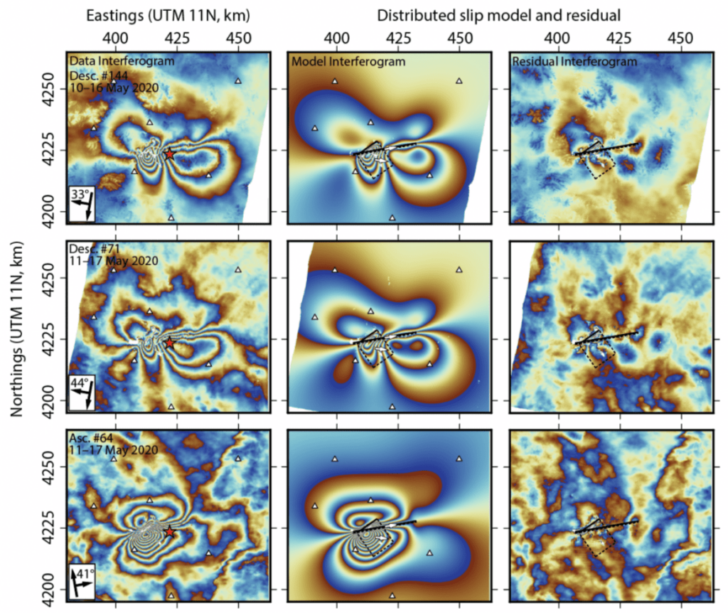
Geodetic slip modelling of continental earthquakes
Source characteristics are a key input in seismic hazard models. My research aims to make careful and detailed observations of the earthquake source. I use InSAR-GNSS joint inversion to model the geometry and slip distribution of the host fault. My previous works include the 2020 Mw 6.5 Monte Cristo Range, Nevada and the 2019 Mw 6.2 Sainyabuli, Laos (manuscript in preparation) earthquakes, where both ruptured previously unmapped faults. In both events, we were able to obtain a visually and quantitatively good fit between observed and model InSAR data, revealing geometrically complex fault segments.
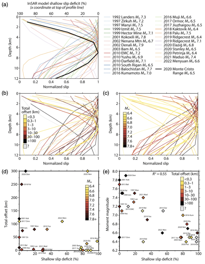
What is the influence of fault structural maturity on rupture behaviours?
Fault structural maturity describes fault zone evolution with incremental offsets and is thought to govern certain aspects of rupture behaviours. For instance, earthquakes on structurally mature faults tend to have more localized deformation along the fault trace. We compared the fault maturity (using cumulative offset as the proxy) with shallow slip deficit (one minus the normalized slip of the surficial row of model subfault patches) of twenty-eight continental strike-slip earthquakes. We found that shallow slip deficit has no correlation with structural maturity as previously postulated, but rather with the magnitude of the earthquake. We are further expanding this study by incorporating more events and multiple maturity proxies.
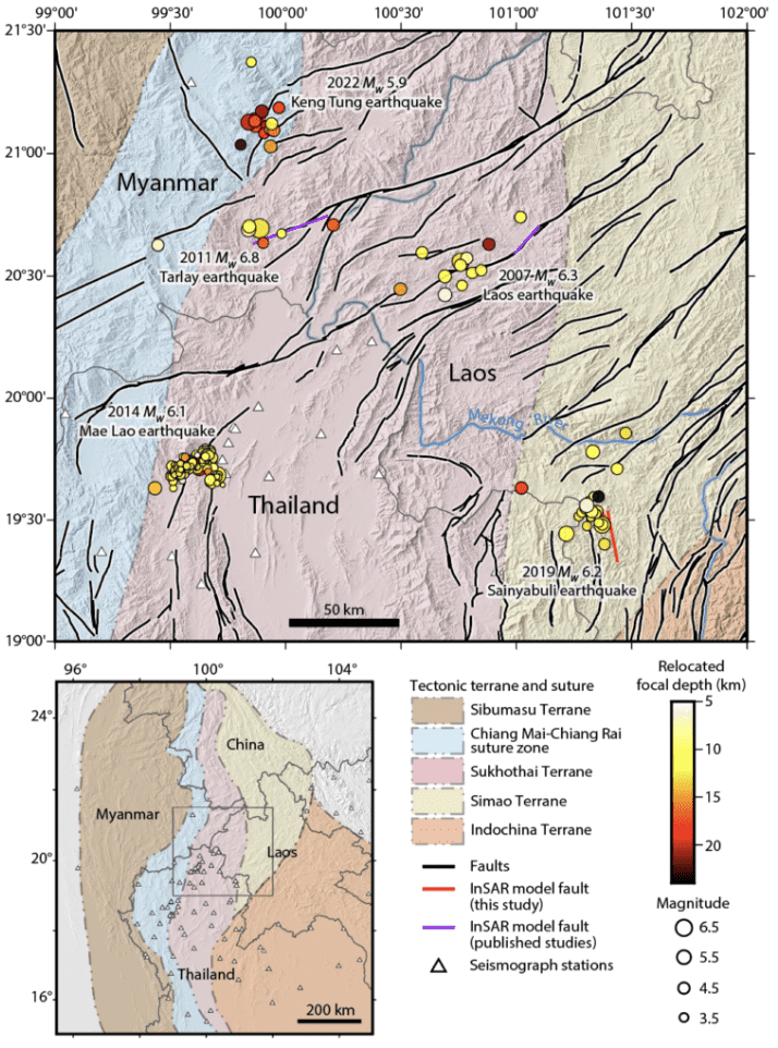
Seismotectonics of Southeast Asia
During 2019–2022, multiple earthquake sequences ruptured the Golden Triangle region (Laos, Thailand, Myanmar) in Southeast Asia. The NE-trending strike-slip faults accommodate extruded materials from the Himilayan collision. However, the 2019 Mw 6.2 Sainyabuli earthquake in Laos (the focus of our study) ruptured a NNW-striking plane (from InSAR). Through international collaboration, we use multiple-event earthquake relocation technique (mloc software) to characterize the aftershock distribution and the seismogenic structure of this region which is poorly understood.
Active tectonics of Panamint Valley, eastern California, United States
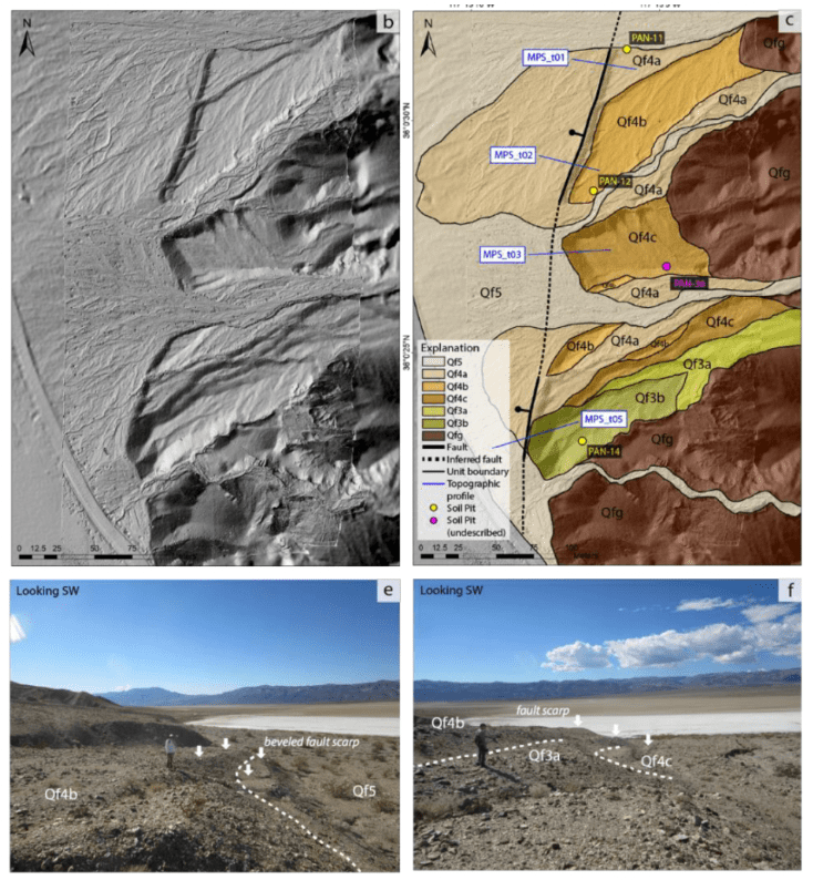
Panamint Valley has one of the most astonishing paleoearthquake alluvial fan records. During my master’s degree, I conducted drone surveys, mapped alluvial surfaces and fault scarps along the Panamint Valley fault system, and incorporated soil chronosequence with alluvial fan depositional morphology to interpret the timing of the earthquakes. We found evidences of Late Holocene events which may correlate to the paleosesimic trench record from previous literature at the southern end of the fault system; this suggests that the most recent earthquake ruptured at least ~45–50 km.
Structure from Motion (photogrammetry)
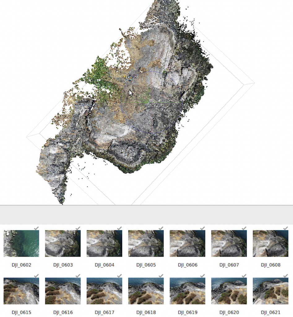
My work has involved Structure from Motion (SfM) processing of data sets of various geologic and terrain settings. This includes:
(1) Fault scarps and Quaternary deposits (Panamint Valley fault research, data available at OpenTopography),
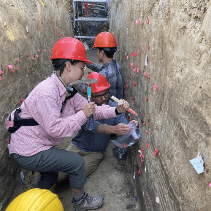
(2) Paleoseismic trench walls
(2.1) XEOLXELEK fault trenching collaborative work
(2.2) Paleoseismic trenching workshop in Sagaing, Myanmar
(3) Bedrock—I designed an integrated SfM-bedrock mapping exercise for an advanced remote-sensing course.